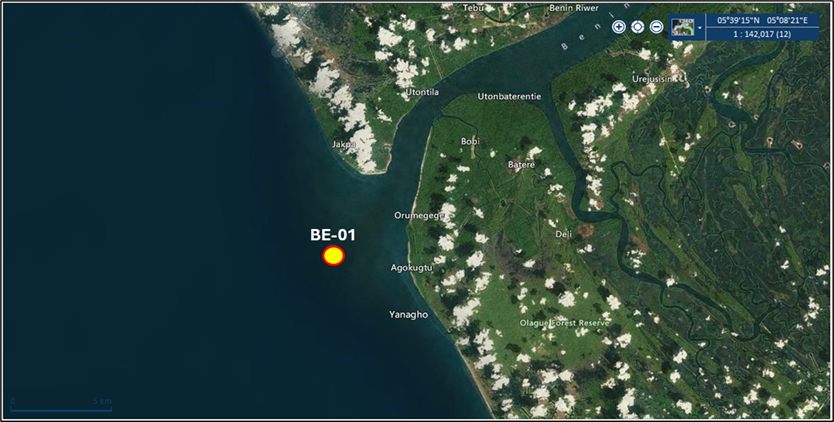
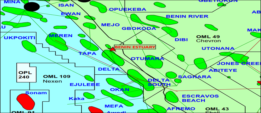
Benin Estuary field is located in PPL 214 situated along the north-western boundary of PML 43 and 49. It is situated in the shallow offshore of the Benin river; less than 4m water depth.. Benin Estuary Field covers an area of 19.6km2 and is located 5km from the mouth of the Benin River, in less than 4-meter water depth offshore the coast of Nigeria. It was discovered in 1988 with the drilling of the BE-01 well which drilled up to 10370 ft MD. The field holds multiple hydrocarbon-bearing sands subdivided into three main sand intervals classified as Shallow, Mid- and Deep reservoirs. The shallow sands are structurally defined and characterized by a high amplitude peak and subtle phase changes to the crest of the structure. The mid-reservoirs are also structurally defined but with more continuous reflector patterns. The deep reservoir interval is purely struro-stratigraphic and formed by a structural unconformity at the base of a major incised channel cut. Extrapolating seismic horizons interpretation beyond the concession also indicates the possible straddling of some hydrocarbon-bearing sands into the adjacent CNL-operated Kito Field in OML-49. Ongoing development activities are in progress to re-enter the existing well (BE-01) for production testing while also progressing unitization discussions to fast-track the eventual field development plan having concluded the definitive unit area assessment.